


Wakayama, a treasure trove of stunning scenery
The Kii Peninsula is like a jack-in-the-box packed with different wonders. Pilgrims have long worshipped the gods that reside on this peninsula covered in deep nature and mountains, with a mysterious beauty that almost feels impenetrable. Nothing beats a bicycle for getting up close to the nature and holy sights of Wakayama so on this occasion, we traveled to the southernmost tip of Honshu, in search of the scenery created by crystal-clear streams and peculiar rock formations.
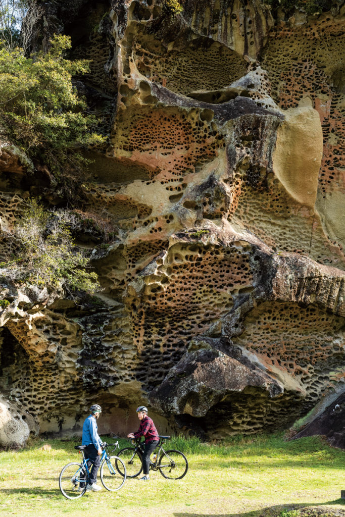
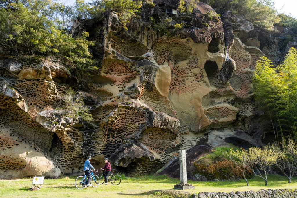
Our guide is Shutaro Ueda, a guide and cyclist who works for Kozagawa Town Tourism Association. After meeting at “Roadside Station Mushikui-iwa“, the start and finishing point of our ride, Shutaro takes us straight to the majestic natural “Mushikui-iwa” rock. This rock is part of the Kumano Caldera formed about 15 million years ago, with a myriad of holes due to weathering and erosion the rocks look as if they have been eaten by insects. “There is a shrine in a cave near the top, and it is said that people in the past climbed this rock with single-tooth geta (clogs) to make a wish,” explains Ueda. It really started to feel like we were in the realm of the mythical, and raised expectations for the scenery that lay ahead.
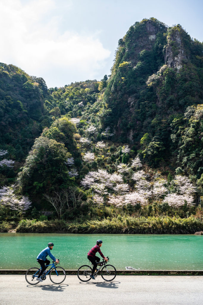
From Mushikui-iwa, we follow part of the Kozagawa River known as “Kumano’s crystal-clear stream” to the coastline of Kushimoto Town (National Route 42), the southernmost town on Honshu. This coastline offers the cyclist a succession of diverse landscapes and delicious local delicacies.
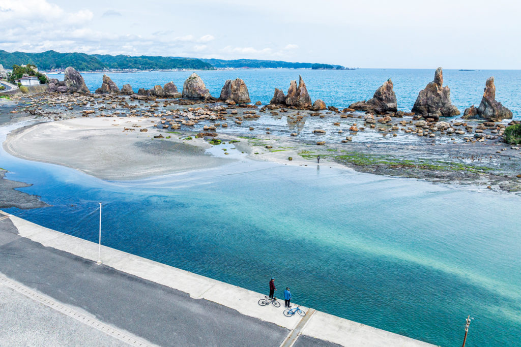
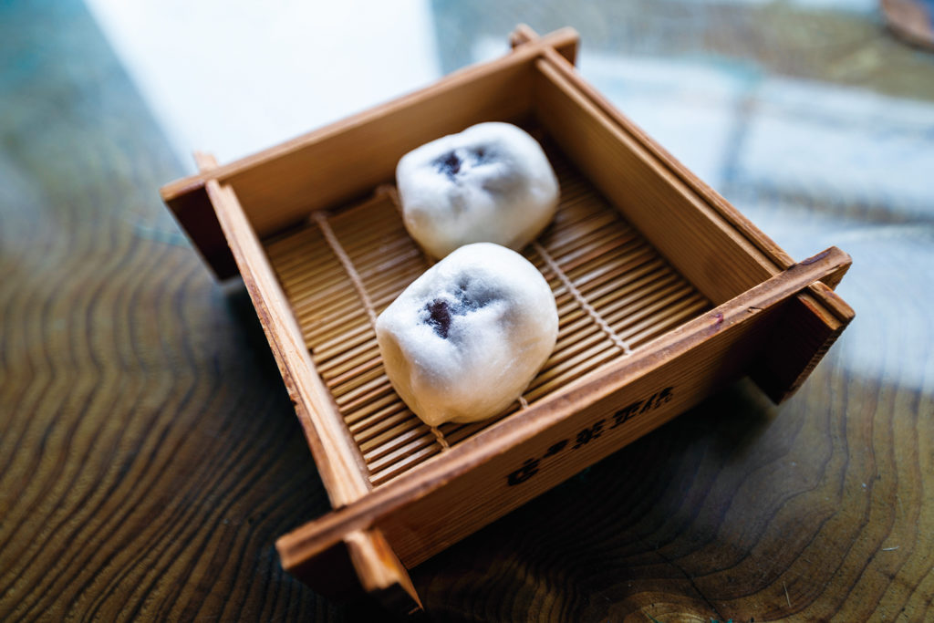
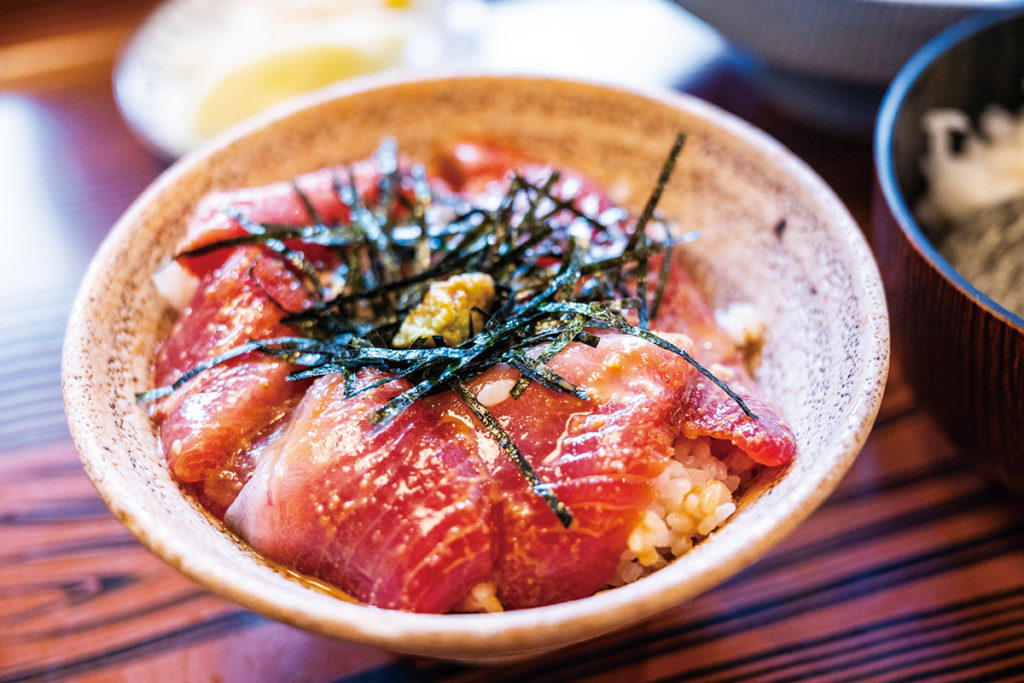
Kuroshima Island and Taijima Island come into view first, the latter earning its name from its resemblance to “tai” (bream). Before long, we come to Hashiguiiwa Rocks, a legendary scenic spot amid bright blue sea where about 40 rock pillars of various sizes are arranged in a row like bridge girders. While listening to the legends about Kobo Daishi and Amanojaku, we chow down on Gihei honten’s “usukawa manju,” a famous manjū bun modeled after Hashiguiiwa Rocks. After Hashiguiiwa, we finally reach the fishing port of Kushimoto, famous for its seafood! A restaurant serving freshly landed fish came highly recommended, and we enjoyed a tasty ochazuke with fresh bonito.
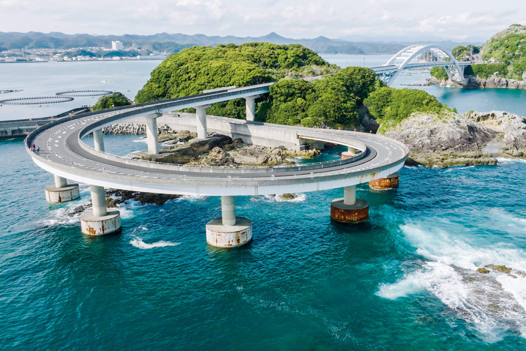
The road leads on to Cape Ushio, the southernmost cape in Honshu, but here we venture around the loop bridge over Kii Oshima. After stocking up on snacks at a popular bakery & cafe, we head across Kii Oshima toward the Kashinozaki Lighthouse. At the end of the cliff, a white stone lighthouse built in 1870 comes into view. The top of the lighthouse affords spectacular uninterrupted views of the sheer rock cliffs, the clear blue sky, and the wild cobalt-blue sea.
From the sea to the mountains, more strange rocks emerge!
We spent the first night in Kushimoto, and in the morning left the coastline behind to finally venture into the mountain part of the tour. The route heads again toward Kozagawa via the 371.
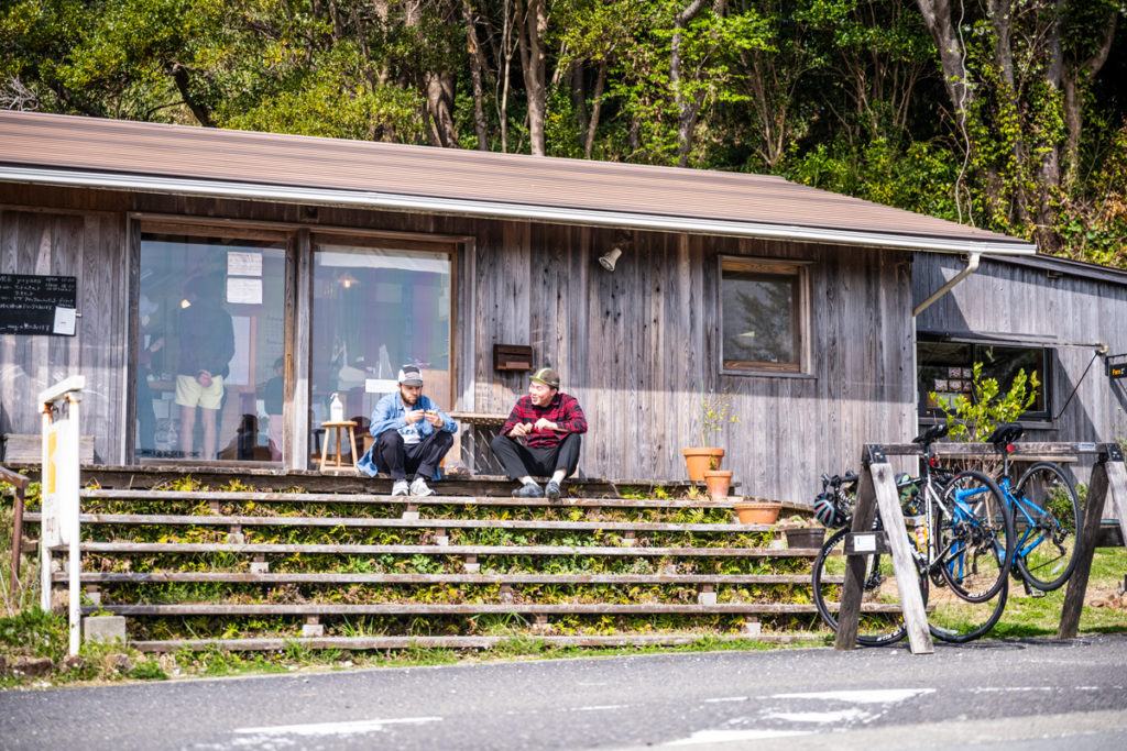
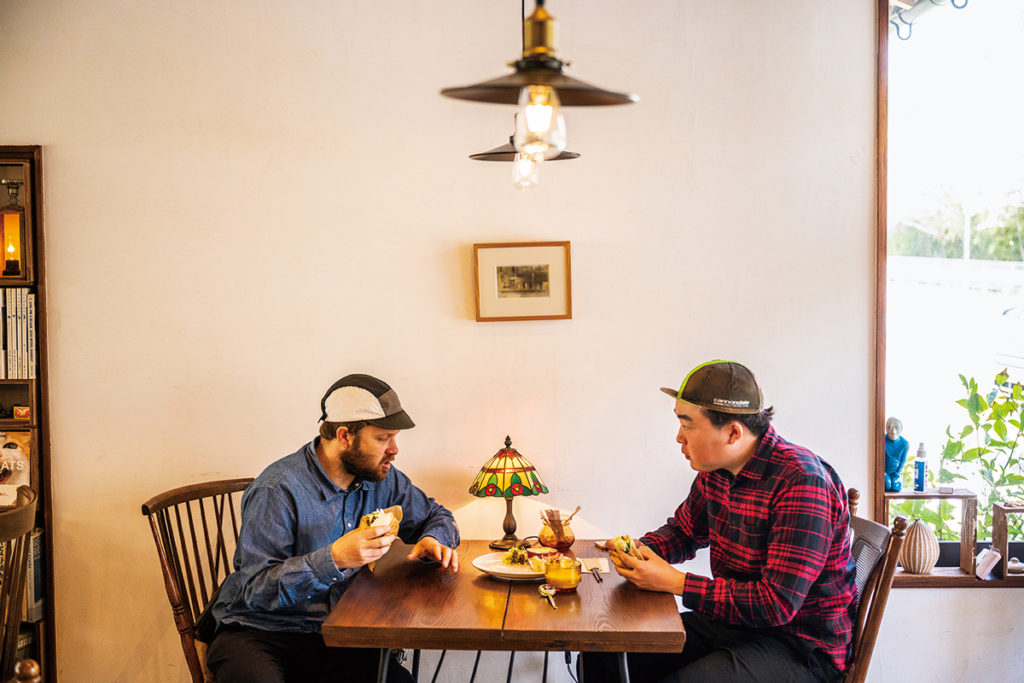
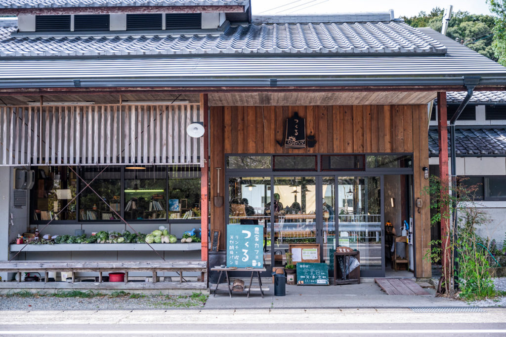
The highlights of day 2 were the clear waters of the Kozagawa River and Ichimai-iwa Monolith, a large rock mass standing 100 meters high and 500 meters wide, one of the largest in Japan. This is also part of the Kumano caldera, but unlike the “insect-eaten” rock, its uniformity of composition and hardness allowed it to maintain this size without being affected by erosion or weathering. On the opposite bank of the monolith is “Roadside Station Ichimaiwa Monolith,” a popular oasis for cyclists. Here, visitors can enjoy the view of the monolith and the local wild game cuisine from Kozagawa, including curry and hamburgers made with venison. There is a campground on the riverbank, and Ueda suggests “carrying all the gear for biking, fishing, and camping on your bicycle.”

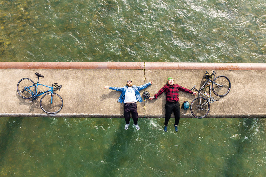
Next, we head east along the Kozagawa River toward the sea. Ueda is keen to visit the Myojin Submersible Bridge in Kozagawa, which is apparently similar to one in the Shimanto River, also designed to be underwater during a flood. This is a fantastic example of design that can coexist with the often-swollen river. There are no handrails in order to reduce resistance to water during floods, and the simplicity of the design is beautiful to behold.
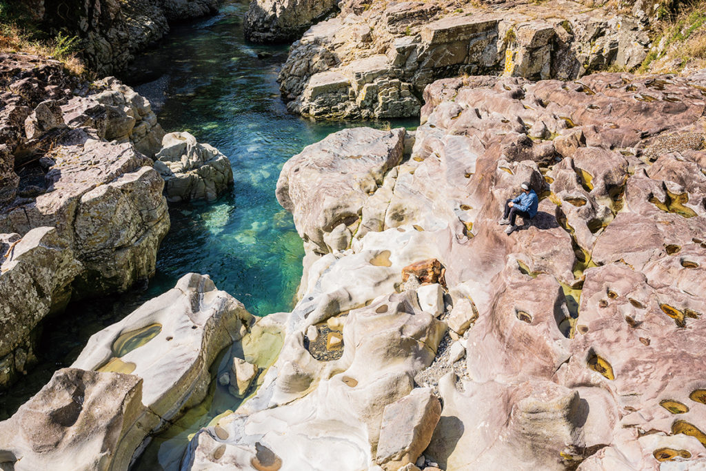
At the junction with Route 43, we go off on a tangent toward the “Taki no Hai” waterfall direction. “Taki no Hai” is a small waterfall located in a stream that is a tributary of the Kozagawa River, and is a spot where visitors can fully experience the “Land of Water.” The contrast between the white rock bed with circular rock holes carved into it and the water so clear that fish swimming in the river bottom can be clearly seen. True to its name as a water that nurtures life, Monk Goby fish (Sicyopterus japonicus) are said to in summer scale the banks of the waterfall in droves.
The route to “Taki no Hai” is a little over 9 km one way with some steep inclines, so only go if you have the energy. Once back on the road along the Kozagawa River, all that remains is to pedal onward to the goal point, Mushikui-iwa.
On a former pilgrimage to Kumano, Emperor Go-Shirakawa penned a poem: “I want to go to Kumano, but if on foot, the road is far and the mountains unforgiving”. The overpowering nature to which he referred is still alive and well on the Kii Peninsula. While Emperor Go-Shirakawa is said to have longed for wings to fly through the sky, today we have our trusty bicycles. Riding on a bicycle joins up the dots between scenic spots, rolling landscapes and old but long-inhabited roads, allowing you to really immerse yourself in the locale.
“With all these detours you can get a bit waylaid, but then again that is the best way to discover the area”. Just as Ueda points out, a bike packing trip through Nanki is just as much about the detours as it is the destination.
Bike Packing Guide
705-1 Ikenoyama Kozagawa-cho, Higashimuro-gun, Wakayama
1489-2 Kujinokawa Kushimoto-cho, Higashimuro-gun, Wakayama
42-17 Kushimoto Kushimoto-cho, Higashimuro-gun, Wakayama
1158 Oshima Kushimoto-cho, Higashimuro-gun, Wakayama
290-2 Aise Kozagawa-cho, Higashimuro-gun, Wakayama
275-1 Furuta Kushimoto-cho, Higashimuro-gun, Wakayama
833 Kushimoto Kushimoto-cho, Higashimuro-gun, Wakayama