


The Yoshino River and “Kareno” are mentioned in the Kojiki
From the Edo period to the Meiji period, the western part of Tokushima Prefecture, known as “Nishi Awa,” prospered thanks to the water transportation industry of the Yoshino River, one of the largest in Japan. The use of boats to travel the Yoshino River has been so enduringly popular that “Kareno” is even mentioned in the Kojiki (Records of Ancient Matters). The Iya Highway was used to transport goods landed at the river port to Iya, the innermost part of the province. Although some of the old highway has been lost due to tree planting, the Iya Highway Trail has been arranged to make walking more enjoyable while soaking up the ambiance of the erstwhile path.
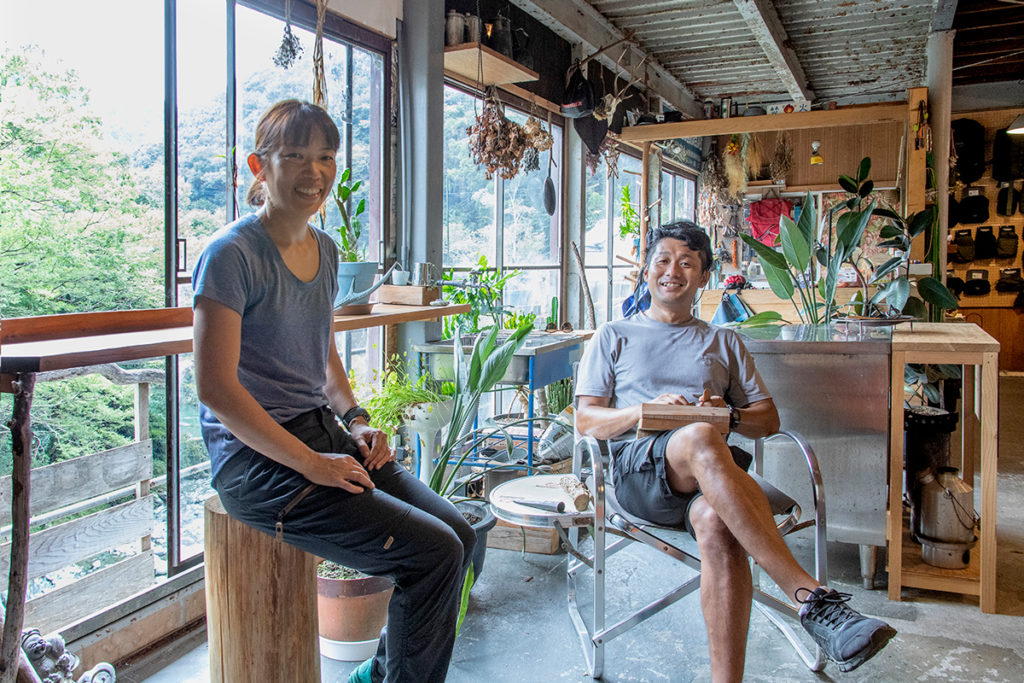
The route was developed by Ken and Aiko Ushio of “Trip Shikoku’s River Navigators,” a mountain and river guide business operating out of the town of Tsurugi. The original Iya Road Trail is about 110km long, from Sadamitsu, through Mt.Tsurugi to Ochiai Village (an important traditional architectures preservation district) to Oku-Iya, where the Kazura Bridge is located, and then on to Iya-kei Gorge. On this occasion, however, Ushio-san will guide us along the 44km east side of the trail. We are accompanied by Janni Olsson, an outdoor-loving reporter and model all the way from Sweden. She’s a big fan of the area, having hiked and camped around Mt.Tsurugi last year, and joins in full mountain gear.
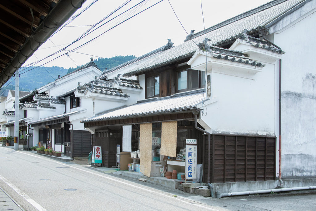
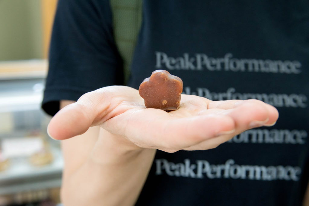
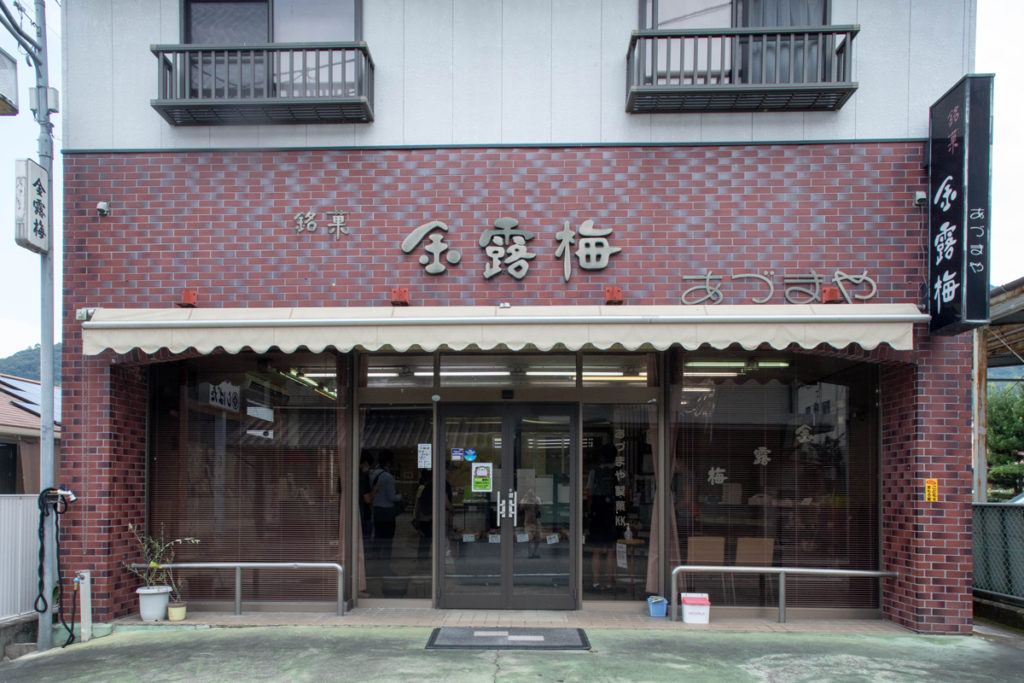
Sadamitsu, the starting point, is one of the river ports that flourished as a commercial and transportation hub. It was once an extremely thriving and bustling place, where people came to buy and sell local specialty products including indigo and tobacco. On the main street, there is a row of merchant houses with the characteristic two-story udatsu (a sleeve wall on the wall of the second floor of a building for fire prevention), which conjures up the ambiance of bygone days. However, rather than the elegant udatsu it was the snacks that caught Lucas and Janni’s attention! They headed to “Azumaya” to buy the famous local confectionery “Kinrobai”, and then to “Kazuya”, a sweet and snack shop established in 1962, to feast on some homemade cake before finally hitting the road.
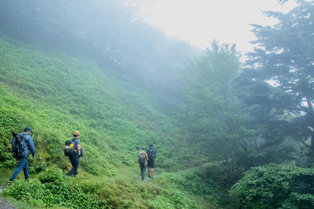
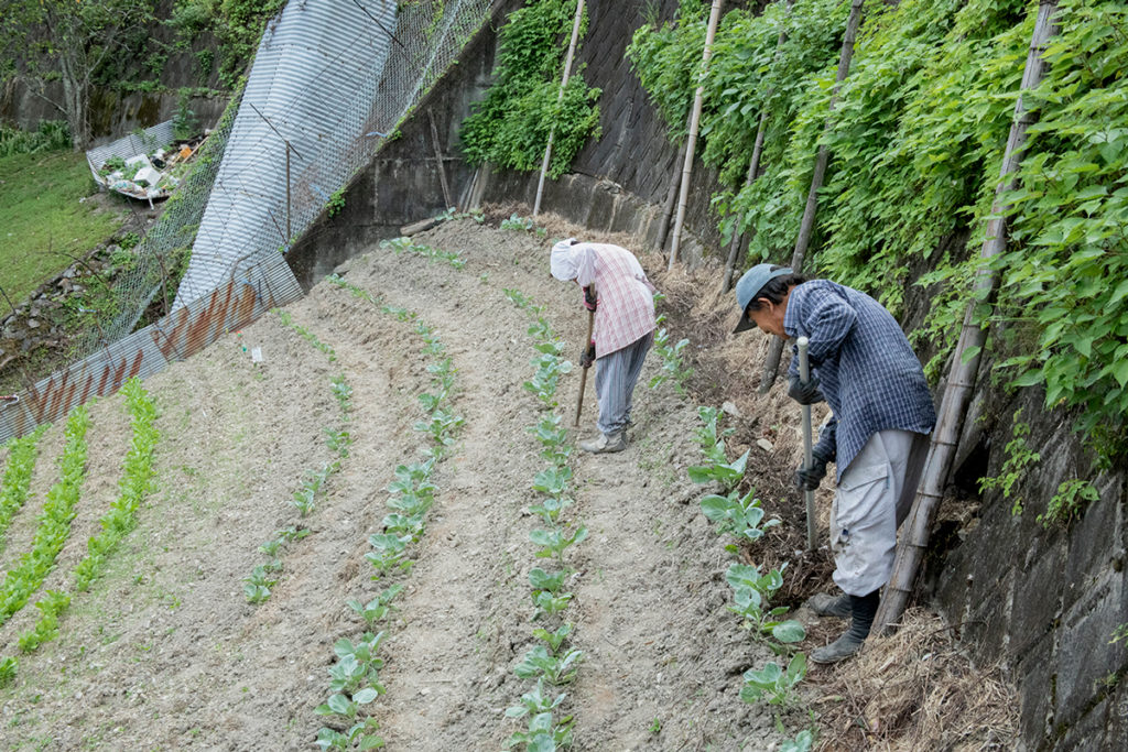
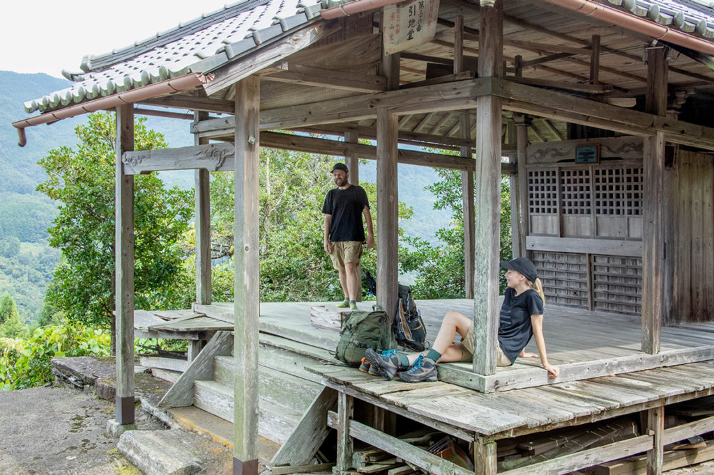
We take the old road from the stone monument in Sadamitsu to the old Mt.Tsurugi road. On the Iya Highway Trail, one needs to be prepared for a steep climb right from the start. Nishi Awa is dotted with as many as 200 settlements in the mountainous area between 100 and 900 meters above sea level. It is so vertiginous that it almost feels strange, with the houses and fields seeming to cling to the slope. While living on steep terrain, our ancestors used their ingenuity to protect and pass on their agriculture, lifestyle, and culture. Recently, the “sloping land farming system,” which contains such “wisdom for life”, has been recognized as a “World Agricultural Heritage” because of its sustainable way of harmonizing humans with the natural environment. We continue on down the trail, our eyes fixed on this “living heritage”. The 80km route is dotted with small shrines frequently used by hikers of the Shikoku 88 Temple Pilgrimage. We stop outside one to have a quick snack break. The “three-way opening,” which is unique to this region, is a perfect setting for hikers to take a break and enjoy the scenery of the mountain village.
The rugged lifestyles of the “sky dwellers“
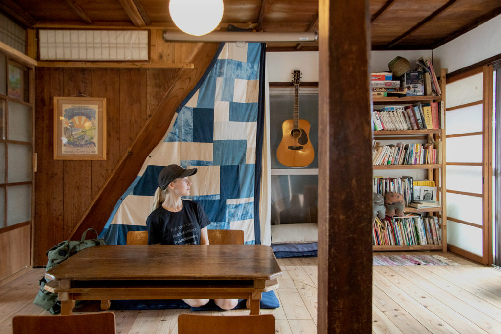
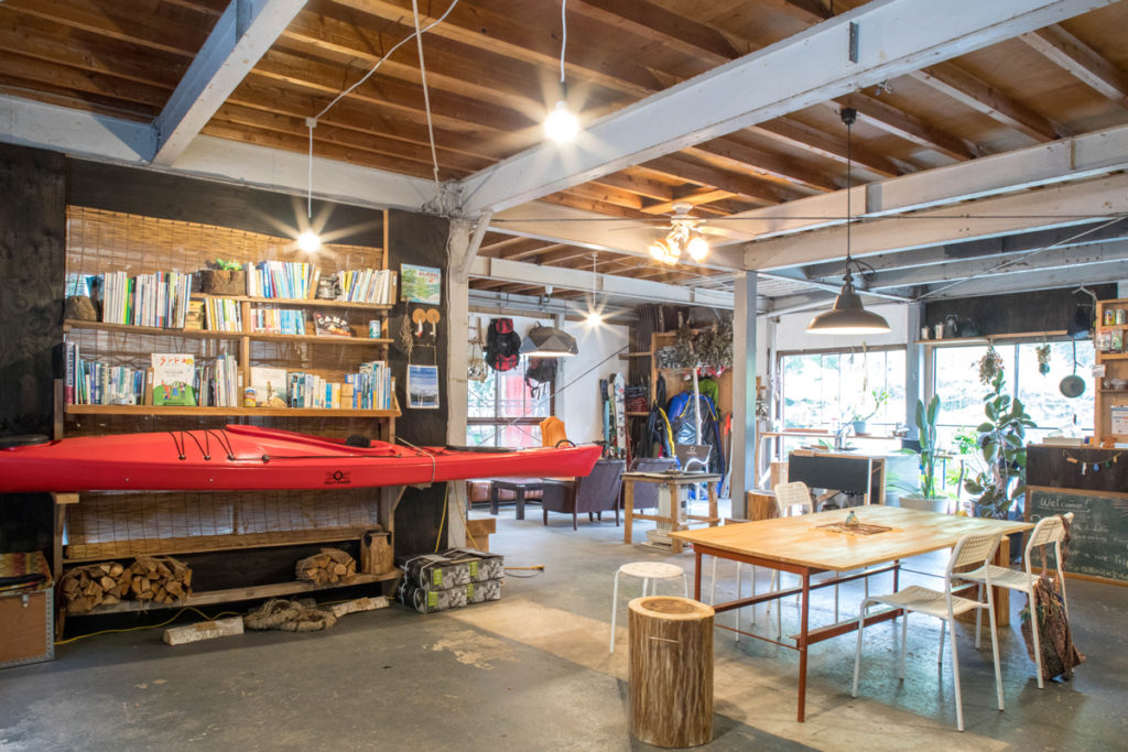
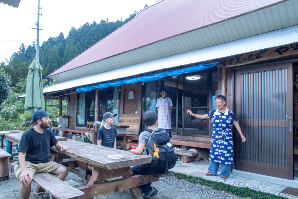
Our lodgings today are at “Yasoshiki“, a farmhouse on one of the steep slope settlements. Proprietor Chiharu Tojo regales us with tales about life in the old days as we feast on local ingredients including native species of potatoes and corn, as well as locally caught venison. Each household around here used to collect seeds of various grains and vegetables, and seeds close to the original species are still being passed down today. As I tasted the sweet potato-like texture of the corn, it occurred to me that the semi-self-sufficiency and bartering culture of these steep slopes has protected the diet of this land to this day.
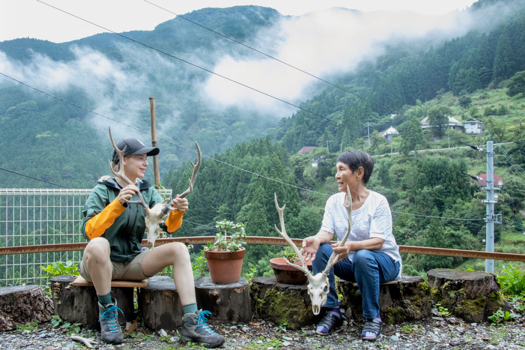
In Nishi Awa, apparently people who live in low altitude areas are called “town dwellers” and those who live in the mountain communities are called “sky dwellers.” Mr.Yoshitoku Kuwahira, who lives in the village of Kuwahira at an altitude of 900 meters, is a dyed-in-the-wool “sky dweller”. He was born and bred in this village, and after an 8-year stint as a “town dweller” for work, found himself returning to the higher reaches. “Living in the sky” means a 10-minute walk from the front door to the driveway, with supplies transported by private monorail. “Once you’ve lived in this environment, you can’t go back down”, explains Kuwahira-san. Aside from the scenery, these “sky dwellers” must love the freedom that comes from not having to care what anybody else thinks.
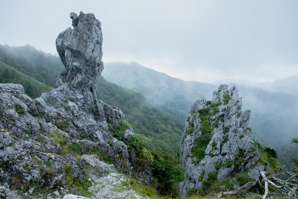
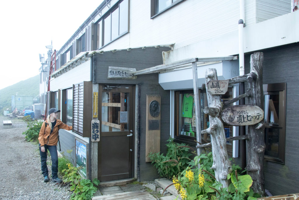
Further up the mountain pass from Kuwadaira village, we finally reach Minokoshi, the trailhead for Mt.Tsurugi. After praying at the Tsurugi Shrine, it’s time to head for the second highest peak in Western Japan. These mountains were once frequented by followers of ascetic mountain worship, and also contain spring water and old trees related to the legend of the fleeing Heike warrior, and a virgin forest of the endangered conifer, Abies veitchi. The wooded areas that appear on both sides of the undulating trail are beautiful. Just as the clouds burst ,we arrive at the mountain lodege at the summit. Opened in 1955, this lodge is proud of the food it serves up to its guests. Home-made dried radish, home-made konnyaku, and salmon tempura. We tuck into a variety of local dishes that made it hard to believe we were on a mountaintop!
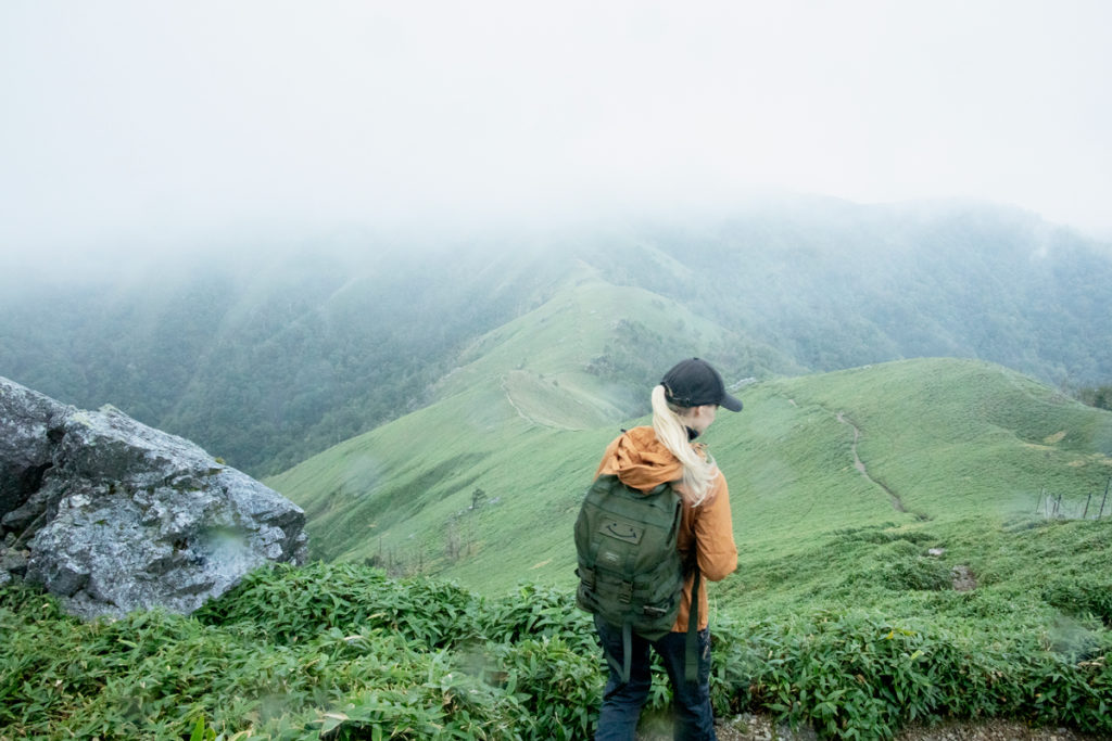
The next morning, we rise early and head to the summit of Mt.Tsurugi. What was supposed to be a 360-degree panorama is unfortunately surrounded by a sea of white clouds. Gazing at the fantastic scenery of Nishi Awa, Janni is inspired: “The clear skies are great, but mountains nestling in a dense sea of clouds are like a fantasy world. I think the misty landscape of the mountains in Japan stirs up an emotion unlike nowhere else on earth.”
Trail Guide
122 Sadamitsu-kaizekawamukai, Tsurugi-cho,
Mima-gun, Tokushima

109 Sadamitsu-azanishiura, Tsurugi-cho,
Mima-gun, Tokushima
40 Sadamitsu-machi, Tsurugi-cho,
Mima-gun, Tokushima

9 Sadamitsu-machi, Tsurugi-cho,
Mima-gun, Tokushima
444 Ichiu-hisayabu, Tsurugi-cho,
Mima-gun, Tokushima
Mt.Tsurugi summit, Koyadairai,
Mima-shi, Tokushima
108-5 Handa-azamatsubae Tsurugi-cho,
Mima-gun, Tokushima
**Please prepare a mountain climbing map for climbing Mt.Tsurugi.